MET ÉIREANN has followed up its orange wind warning from earlier this morning with a further level red warning for West Cork.
According to Met Éireann, 'gale force southerly winds becoming westerly will bring severe, damaging and destructive gusts in excess of 130km/h.'
The red warning is in place from 03.00am on Friday, January 24th until 10.00am the same morning.
Update Thursday, January 23rd 09.00am
Met Éireann has on Thursday morning updated all three of it's weather warnings from the previous day.
The red wind warning now includes every county in Ireland and is in place from 02.00am on Friday morning until 10.00am the same morning.
After that, an orange wind warning remains in place until 16.00.
The yellow warning for rain, which was also issued yesterday, has been extended.
It is now in place from 09.00pm on Thursday until 05.00am on Friday, January 24th.
Update 16.50pm
Cork County Council Update Ahead of Storm Éowyn Status Red Wind Warning for Cork
Cork County Council is urging people to take action to protect themselves and their property ahead of a Status Red Wind Warning for Cork which comes into effect during the early hours of Friday morning.
The highest-level warning for severe, damaging, and destructive gusts in excess of 130km/h will be in place for Cork from 2.00am until 10.00am on Friday. The public is being advised to stay indoors and not to travel during the warnings.
Met Éireann is warning Storm Éowyn has the capacity to bring severe winds which will constitute a risk to life and property.
The impacts include:
- Danger to life
- Extremely dangerous travelling conditions
- Wave overtopping
- Coastal flooding in low lying and exposed area
- Unsafe working conditions
- Fallen trees
- Significant and widespread power outages
- Structural damage
- Cancellation of events
- Disruption and cancellations to transport
A Status Orange Wind warning will then be in place until 5.00pm on Friday evening. Heavy rain leading to localised flooding is also forecast for Cork with a status Yellow Rain warning in place from 9.00pm on Thursday night until 3.00am on Friday morning.
Cork County Council’s Severe Weather Assessment Team convened this afternoon to plan for the severe and destructive storm.
Council crews have been deployed to inspect key high-risk areas and will continue to monitor the situation throughout the period. Pumping arrangements will be in place in known problem locations.
The public is advised to stay away from coastal areas during this period. The Irish Coast Guard is appealing to people to “Stay Back, Stay High, Stay Dry”. There is the potential for tidal flooding in coastal areas.
The electricity network is expected to be severely impacted; the public is advised to prepare for the arrival of the storm including ensuring their mobile phone is fully charged to enable communication.
ESB Networks is highlighting the dangers posed by fallen live wires and is advising the public and the emergency services to stay away from these fallen cables and to report such cases to it immediately. ESB Emergency Services can be contacted at 1800 372 999. The public can monitor www.PowerCheck.ie in regards to power restoration times.www.PowerCheck.ie
Uisce Éireann customers can check the website and social media channels for updates and to get in touch with any issues or concerns via their 24/7 customer care centre at 1800 278 278.
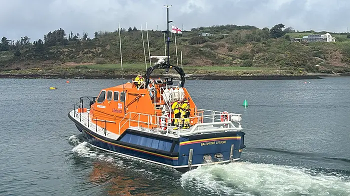
Dursey Cable Car will be open to Islanders only tomorrow, Thursday the 23rd of January. It will be closed to all traffic on Friday. Reopening will be subject to weather conditions and a post storm inspection.
Issues can be reported overnight on Thursday and throughout Friday to the Council’s Emergency Number (021) 4800048.
In the event of an emergency call 999 or 112 and request the Fire Service, Ambulance Service, Gardaí or Irish Coastguard as appropriate. DO NOT assume others will do this.
Weather updates are available at www.met.ie. Cork County Council will continue to provide updates on www.corkcoco.ie and across the Council’s social media channels @Corkcoco.
Update 14.45pm
Met Éireann has released an updated list of the potential impacts of Storm Éowyn ahead the red wind warning and several other alerts which come into effect on Thursday night.
The status Red wind warning comes into effect at 02.00am on Friday, January 24th and is in place until 10.00am the same day.
The full list of potential impacts are as follows:
Danger to life
Extremely dangerous travelling conditions
Unsafe working conditions
Disruption and cancellations to transport
Many fallen trees
Significant and widespread power outages
Impacts to communications networks
Cancellation of event
Structural damage
Wave overtopping
Coastal flooding in low-lying and exposed areas
Update 14.20pm
Experts warn that Storm Éowyn will be an 'historic' storm with a severity rivalling all others in recent memory, including Storm Ophelia.
That high resolution AROME model out to 9am shows gusts I’ve never seen this model show before for Ireland and this model is one of the best there is for Ireland. Anyone saying this is just another storm is in for a rude awakening. This will be an historic storm. #StormÉowyn pic.twitter.com/qQSYYqsKSc
— Carlow Weather (@CarlowWeather) January 22, 2025
🚠 Due to Storm Éowyn, the forecasted wind speeds at Dursey Cable Car require restrictions on travel.
⚠️ On Thursday the 23rd of January 2025, the Cable Car will be open to Islanders only.
⚠️On Friday the 24th of January 2025, the Cable Car will be closed to all traffic.ℹ️… pic.twitter.com/GwWUjho6dy
— Cork County Council (@Corkcoco) January 22, 2025
Update 11.39am:
A separate rain warning has been put in place regarding Thursday, January 23rd.
The level yellow warning is in place from 9pm on Thursday until 03.00am on the morning of Friday, January 24th.
The previous yellow warning remains in place until 09.00am on Friday, when Red and Orange warnings for wind are also active throughout the day.
Update 11.07am:
The red weather warning will expire on Friday, January 24th at 10.00am but an orange weather warning remains in place until 5 pm.
Update 10.45am:
In addition to the wind, Storm Éowyn will also bring rain as confirmed by the rain warning issued by Met Éireann.
The status yellow warning is in place from 03.00am on Friday, January 24th until 09.00am the same morning.
Impacts:
Danger to life
Extremely dangerous travelling conditions
Cancellation of events
Wave overtopping
Coastal flooding in low lying and exposed areas
Unsafe working conditions
Fallen trees
Significant and widespread power outages
Structural damage
Check back here for updates.