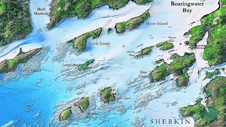
NEW maps of the Irish coastline developed over 10 years aim to bring a new clarity to the West Cork seascape.
The maps of the coastline, from Bantry Bay to Roches Point, were developed by Infomar, and highlight the intricate landscape in areas from the Beara peninsula to Mizen Head, and from Cape Clear to Roaringwater Bay and Cork harbour.
Infomar (integrated mapping for the sustainable development of ireland’s marine resource) has launched the Blue Scale map series; a collection of 18 high-resolution bathymetric maps of Ireland’s coastal waters. Developed by a dedicated team of hydrographers, data processors and cartographers, the maps highlight the topography of the coast in remarkable detail.
Infomar was established in 2006 and is one of the world’s largest seabed mapping programmes. It is funded by the Department of the Environment, Climate and Communications, and is a joint venture by the Geological Survey Ireland and the Marine Institute. Infomar aims to map Ireland’s seabed and deliver a comprehensive baseline bathymetry – the measurement of depth of water in oceans, seas, or lakes – dataset to aid future management of Ireland’s marine resource.
Ireland’s coastline is approximately 3,171km in length and each week Informar will be releasing a new map of a different section of the coast.
Co Cork boasts a coastline of approximately 1,200km – and the latest published in the new map series are the Blue Scale bathymetric maps of Bantry Bay, Mizen Head, Roaringwater Bay, Galley Head, and Cork harbour. The five maps, released on a weekly basis over five weeks, reveal the brilliant marine geology and unique seafloor.
The first map of the Cork coastline released is the Bluescale bathymetric map of Bantry Bay, which runs 35kms and is witness to numerous shipwrecks over the years. In 1981, while clean-up efforts using sonar sweeps for the Betelgeuse were under way, the wreck of the French frigate La Surveillante, which had been scuttled during a storm north of Whiddy Island on 2 January 1797, was found. The La Surveillante has since been mapped in high resolution by Infomar.
This week, the map of Mizen will be released. Mizen Head is traditionally regarded as the most southerly point of mainland Ireland, although Brow Head is the actual southernmost point, beating Mizen Head by nine metres.
The map also includes ‘Ireland’s Teardrop’, Fastnet Rock, and Roaringwater Bay. The Seven Heads peninsul map will be released on October 6th.


